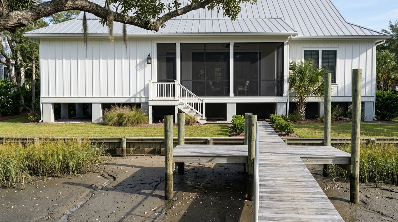
What Murrells Inlet Waterfront Dredging Really Means
August 13, 2026
August 13, 2026
Two homes go on the market the same week, both marketed as Murrells Inlet waterfront, both with a private dock in the listing photos. One of them backs up to a creek segment that just received real dredging funding. The other backs up to a creek that has never had a full-scale dredge in its history and is currently the subject of an unresolved federal permit fight. From the listing sheet, you cannot tell which is which. That gap is the whole story right now.
Murrells Inlet has spent the better part of a decade waiting on a dredging project that keeps almost arriving. Understanding where that project actually stands, which creeks it touches first, and what the water and permitting rules mean for a dock you don't yet own is the difference between paying a waterfront premium for something real and paying it for a promise.
Georgetown County started planning what's now called the Murrells Inlet Navigation Project back in 2019. The county applied to the Army Corps of Engineers in 2023 for a permit to dredge more than 750,000 cubic yards of material and pump it to a nearshore disposal site off Huntington Beach State Park, a plan reported by Coastal Observer. As of late July 2026, the county is still seeking final permits to dredge nearly 16.5 miles of creeks and channels across the estuary, a scope that includes named waterways like Flaggpoint Creek, Oaks Creek, Allston Creek, Main Creek, Parsonage Creek, and the creeks near Morse Park Landing and Graham's Landing, according to reporting on the current permit fight.
That same reporting notes something worth sitting with if you're comparing creek lots: Oaks Creek, Allston Creek, Creeks A and B, and the stretch of Main Creek upstream of the federal channel have never received full-scale dredging before. These aren't creeks getting a routine maintenance pass. They're creeks that have been silting in, uncontested, for years, which is exactly why the current environmental review is contentious. The South Carolina Environmental Law Project has argued the county's own consultant underestimated the impact to oyster beds in several of these creeks, pointing to field photos showing dense oyster growth in spots the county's map marked as unaffected. One independent surveyor's comparison found
"oysters were abundant and widely distributed"
in creeks the county's application said would see no impact.
None of that makes the project unlikely. Georgetown County's Director of Public Services has said the plan carries strong community support, especially from landowners who have lost access to the inlet from their own homes. But it does mean the timeline reported in late 2024, a fall 2026 start with three phases over three years, per ABC News 4's coverage, was a projection made before the current round of federal review was even filed. That projection is roughly 20 months old now. Fall 2026 is essentially here, and as of this summer the project is still working through a contested federal permit process rather than breaking ground, which is not something you should treat as already priced into a listing.
Money tells you more than press releases do. Georgetown County's own appropriations filing puts the total dredging cost at roughly $35 million, with $10 million currently earmarked, according to the county's FY24 appropriations documentation. A separate 2024 report on the project put the total closer to $37 million, a reminder that even the price tag has moved since planning began. That first $10 million tranche is designated for a specific initial phase covering portions of Main Creek along the South Waccamaw area of Garden City and its related tributaries, per the same filing.
That's a meaningful detail for anyone shopping creek lots inside Murrells Inlet proper rather than the Garden City-adjacent stretch of the same waterway system. The first funded, first-in-line work targets a different segment of the system than several of the creeks named in the current federal permit fight. If a listing agent tells you dredging is coming to a specific creek, the honest follow-up question is which phase, and whether that phase has an actual funding source yet or is still part of the remaining $25 million the county hasn't secured.
Even if your creek gets dredged on schedule, dredging solves depth. It doesn't solve whether you're allowed to build a dock at all. South Carolina's Department of Environmental Services regulates private docks based on the width of the creek itself, measured from marsh grass to marsh grass, not on the size of your lot or your enthusiasm for boating.
The current rule, laid out in the state's own critical area permitting FAQ, is specific: on creeks narrower than 20 feet, no dock structure is allowed at all, with a narrow exception if the property has at least 500 feet of frontage or there's no potential dockage from the opposite bank. Even in that exception, boat lifts and boat storage docks are off the table entirely, and the structure is capped at 50 square feet. Wider creeks allow more, with docks permitted up to 1,000 feet in some cases depending on creek width, per guidance from a Grand Strand marine contractor's dock permitting FAQ. The same source puts the typical private residential dock permit timeline at around 120 days from application to approval, assuming no complications.
Before you assume a creek lot comes with a real dock, or before you count on adding one after closing, it's worth checking a short list:
Waterfront carries a cost beyond the purchase price, and it's not uniform even within the same few blocks. Statewide, the average NFIP flood insurance policy in South Carolina runs around $929 a year according to a 2025 industry analysis, though that figure moves a lot by location. In Horry County specifically, which borders the Murrells Inlet market on the Grand Strand, the average NFIP premium sits closer to $448 a year across roughly 22,000 active policies, per a 2026 rate breakdown from Moore & Associates.
Those county and state averages blend two very different pools. Homes directly on the marsh or creek typically sit in higher-risk AE zones, where annual premiums run meaningfully higher than the county average once you factor in elevation and building age. Homes a few blocks inland, often in the same subdivision, frequently sit in lower-risk X zones with premiums well below that average. The gap is large enough that it changes what you're actually comparing when you look at two homes with similar square footage and a similar asking price, one marked waterfront and one marked water view. An elevation certificate from a licensed surveyor is the only way to know where a specific property actually lands, and it's worth requesting before you finalize an offer rather than after.
Put together, the sequencing question, the creek width rule, and the flood zone spread mean two listings that look identical on paper can carry very different real costs and very different odds of delivering what the photos promise. A creek lot in the currently funded phase, wide enough to support a real dock, sitting in a moderate flood zone, is a different asset than a narrow-creek lot in an unfunded phase with an insurance bill that erases half the perceived savings. Both might be called waterfront. Only one of them is waterfront you can use on a normal timeline.
If you're comparing Murrells Inlet creek lots against inland options in places like Prince Creek or Wachesaw Plantation, this is the layer worth running down before you fall in love with a view. It's the kind of homework that takes a phone call to the right people, a look at the current permit filings, and someone local who already knows which creeks are in this fight and which aren't.
Which creek is being dredged first? The county hasn't published a public phase-by-phase map naming every creek in order. The only confirmed first-phase funding, $10 million of the roughly $35 million needed, targets the Main Creek section along the South Waccamaw area of Garden City, not the Murrells Inlet creeks currently under federal environmental review.
If a creek is too narrow for a dock, is there any way around it? The 500-foot frontage exception is the only path under current DHEC rules, and even then the structure is capped at 50 square feet with no boat lift or boat storage allowed. It's worth confirming creek width with a survey before assuming a workaround applies.
Does flood insurance cost the same for every waterfront home in Murrells Inlet? No. Zone and elevation drive the premium far more than the address does. An elevation certificate is the document that actually answers the question, and it's worth getting before you're locked into a contract.
If you're weighing a Murrells Inlet waterfront lot against an inland alternative, or trying to figure out which creek segment actually earns its premium, Dan Benish can walk through the current dredging phase status, the dock permit picture for a specific lot, and what your real carrying costs would look like before you make an offer. Reach out for a consultation, or start with a home valuation if you're weighing a sale on the other side of this market.
Stay up to date on the latest real estate trends.
Contact Dan today to learn more about his unique approach to real estate and how he can help you get the results you deserve.
100 Greenway Blvd Murrells Inlet, SC 29576